



Map Tools Free Trial

Mô tả của Map Tools Free Trial
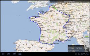
Use Google Maps to carry out various measurements.
To help you out, a number of functions are available in this trial version :
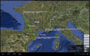
- Distance, perimeter and area calculations
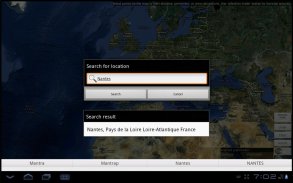
- WGS84 GPS coordinates display
- Unit of measurement : meter, mile, hectare
- Integrated UI to GOOGLE Maps tool
- Selection mode to enhance accuracy
- GPS localization
Why use map tools :
- Measure the area of agricultural land or estate
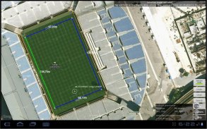
- Estimate the surface or actions of a dwelling, swimming pool, terrace or future construction site
- Establish the perimeter of your yard to prepare for possible closures.
- Prepare surfaces for organizing your leisure and outdoor activities
- Sports, find a surface to improvise a football field, volleyball, golf, trail running and other sports ..
- In golf, prepare your journey with many paths and optimal distance measurements
- Before a trip, quickly calculate multiple routes
- Aviation, calculate the distances of your flight plan
- ...
The Map Tools algorithm relies on the method for computing the area of a surface on a sphere, based on the Haversine formula. This algorithm was modified to take into account the earth's deformation according to the WGS84 World Geodesic System.
Keyword : measure map maps area distance distances tool tools area perimeter perimeters surveyor surveyors planimeter planimeters satellite gps mesurer carte cartes surface surfaces superficie superficies distance distances outil outils tool aires périmètres géomètre géomètres planimètre planimètres arpenteur arpenteurs satellite gps
</div> <div jsname="WJz9Hc" style="display:none">Sử dụng Google Maps để thực hiện các phép đo khác nhau.
Để giúp bạn ra ngoài, một số chức năng có sẵn trong phiên bản thử nghiệm này:
- Khoảng cách, chu vi và tính toán diện tích
- WGS84 tọa độ GPS hiển thị
- Đơn vị đo lường: mét, dặm, ha
- Tích hợp giao diện người dùng cho công cụ GOOGLE Maps
- Hình thức lựa chọn để nâng cao độ chính xác
- Nội địa hóa GPS
Tại sao sử dụng công cụ bản đồ:
- Đo diện tích đất nông nghiệp, bất động sản
- Ước tính bề mặt hay hành động của nhà ở, hồ bơi, sân thượng hoặc tương lai công trường xây dựng
- Thiết lập chu vi của sân của bạn để chuẩn bị cho việc đóng cửa có thể.
- Chuẩn bị bề mặt để tổ chức giải trí của bạn và các hoạt động ngoài trời
- Thể thao, tìm thấy một bề mặt để ứng biến một sân bóng đá, bóng chuyền, sân, đường mòn chạy và môn thể thao khác ..
- Trong sân, chuẩn bị cho cuộc hành trình của bạn với nhiều con đường và các phép đo khoảng cách tối ưu
- Trước khi một chuyến đi, nhanh chóng tính toán nhiều tuyến đường
- Hàng không, tính toán khoảng cách của kế hoạch bay của bạn
- ...
Bản đồ thuật toán Công cụ dựa trên các phương pháp để tính toán diện tích bề mặt trên một quả cầu, dựa trên công thức Haversine. Thuật toán này đã được sửa đổi để đưa vào tài khoản biến dạng của trái đất theo hệ thống đo đạc Thế giới WGS84.
Từ khóa: biện pháp bản đồ bản đồ khu vực khoảng cách khoảng cách công cụ công cụ khu vực chu vi chu vi khảo sát trắc địa planimeter planimeters vệ tinh gps mesurer carte Cartes bề mặt mặt superficie sự cạn khoảng cách khoảng cách Outil outils công cụ aires périmètres géomètre géomètres planimètre planimètres arpenteur arpenteurs vệ tinh gps</div> <div class="show-more-end">


